Lincoln Boulevard in Santa Monica is about to undergo a dramatic transformation. The stretch of Lincoln that runs from the 1-10 freeway to Santa Monica’s southern border, controlled by CalTrans until 2012 when Santa Monica took it over, is being reimagined as a multimodal, pedestrian-friendly street complete with bus lanes, more crosswalks, parklets, and (some) better bike facilities.
Next Wednesday, September 2, the Santa Monica Planning Commission will take a look at some of the preliminary designs for the Lincoln Neighborhood Corridor (LiNC) plan that have come out of an ongoing community process. People can still weigh in on the plans online here by voting on details like preferred street lighting models, number of medians, locations of crosswalks, and even street plantings.
There’s a lot of promising stuff happening, especially since Lincoln Boulevard has served primarily as a thoroughfare for vehicles. As a result, the streetscape can be pretty hostile and dangerous. Former Planning Commissioner Frank Gruber weighed in on the LiNC here.
Here’s a look at some of what could happen on Lincoln Boulevard. All of the images and renderings are from the city’s LiNC website.
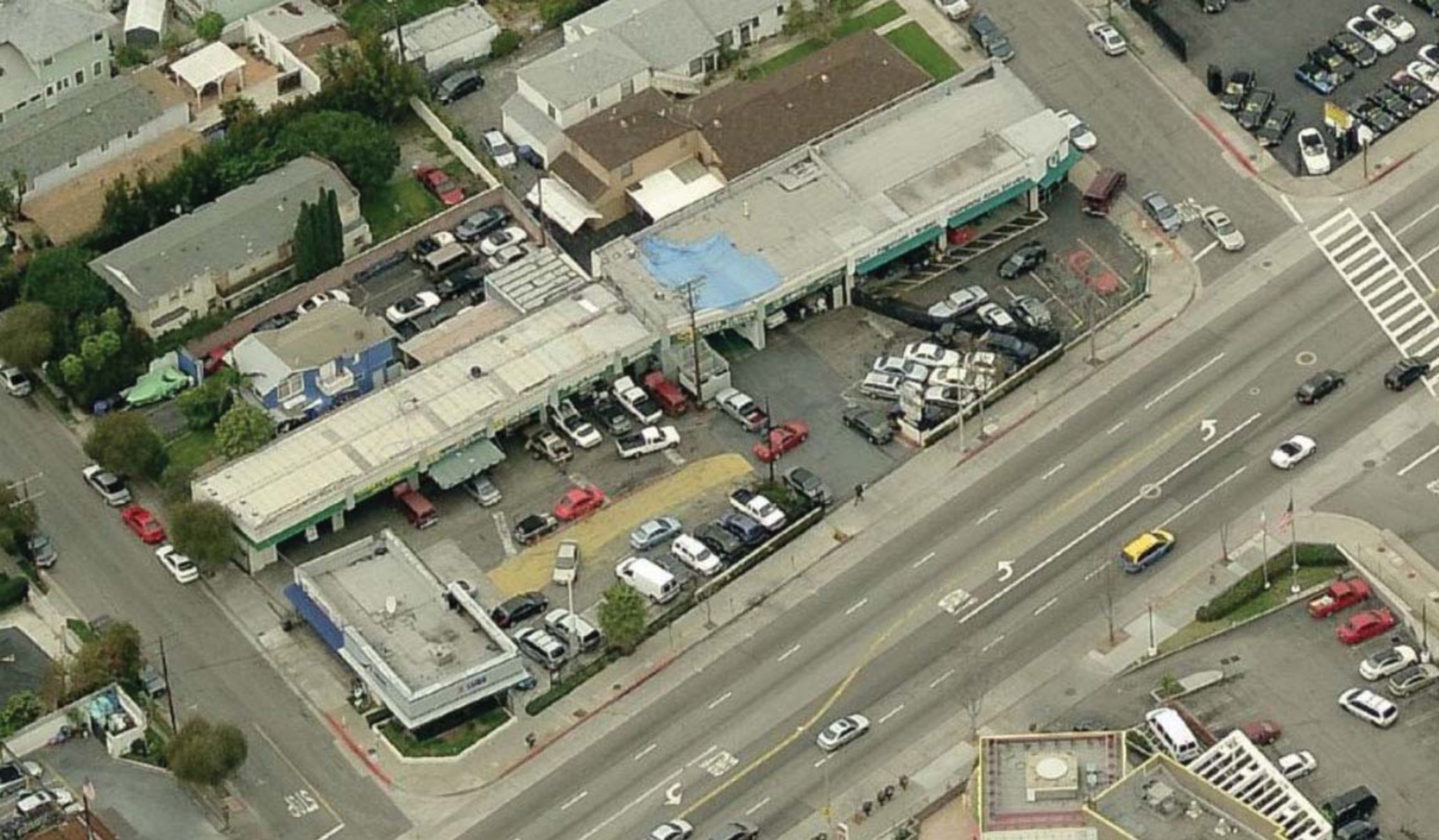
Major improvements are being considered for the street’s built environment. By emphasizing pedestrian-oriented adaptive reuse, the city hopes to turn buildings like this old auto shop…
…into something like this:
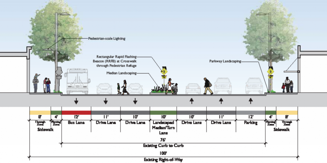
 Then, there are plans to add in dedicated peak-time bus lanes, medians, better sidewalk lighting, more crosswalks, better street furniture, signage, bulb outs, and parkway landscaping to improve the experience for those who walk Lincoln Boulevard.
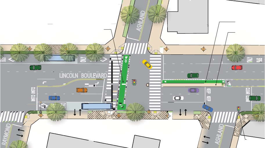
 The city is also considering improvements to connect Lincoln to Santa Monica’s bike network. Below are two options for creating a safer route for people on bikes crossing Lincoln at Ashland.

 There don’t appear to be plans to put bike lanes on the Lincoln itself thought, which is likely due to the prioritization of dedicated bus lanes.
The goals of the LiNC plan are stated on the website and include reducing barriers to pedestrian access and comfort, reducing or eliminating conflicts between vehicles, bicycles, and pedestrians, increasing the number of crossings to promote pedestrian and bicycle movements across the boulevard and into the neighborhoods, improving sidewalks with amenities that would encourage more walking, improving wayfinding and legibility to key destinations like Santa Monica High School, the Beach and Downtown, and improving and diversifying landscaping and tree canopy.
According to city staff, “Many of the streetscape design elements have been evaluated and endorsed by the community. However, several outstanding questions about key corridor improvements remain that will impact the final design.”
City officials want people to weigh in here to help finalize the designs. It’s possible that Lincoln Boulevard in Santa Monica will become a multi-modal street in the near future. For more info, visit lincsm.net.
Santa Monica Next is published thanks to the support of our advertisers: Bike Center, Pocrass and De Los Reyes LLC Personal Injury Attorneys and Los Angeles Bicycle Attorney.