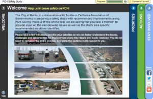
Last week, the City of Malibu released a draft study addressing safety issues on the 21 miles of Pacific Coast Highway (PCH) that runs through the city. The release coincided with the launch of an online survey to garner feedback from the public on a series of possible safety improvements.

The 65-page report was prepared by the Irvine-based consultant firm LSA Associates. It lists 80 potential safety issues and lists solutions in order of importance. A list of all the strategies suggested in the report can be found at the bottom of the article.
The report’s proposed solutions are mostly about freeing the PCH somewhat from its car-dominated status, including the addition of 21 miles of bike lanes, adding parking meters to parts of the road, and adding more crosswalks and signage at unmarked crosswalks throughout the corridor. Improved access for disabled passengers at bus stops, and improved line-of-site for drivers at some of the wavier parts of the road are also suggested. The PCH currently has seven lanes, two wide shoulders (sometimes used for parking,) four mixed use lanes, and a center turn lane.
“They’re really trying,” says Hans Laetz, a journalist and historian who is working on a book on the history of the PCH. “The $64,000 question is will the city council have the political will to do this. These will be some very very difficult issues for the City of Malibu.”
Laetz announced Malibu’s launch of this study on Streetsblog in 2011 and recently ran an unsuccessful campaign for City Council.
Things have changed in Malibu’s government since 2010, when Safety Commissioner Susan Tellem started a Facebook page begging the California Highway Patrol to target cyclists for tickets. Cyclists swarm to the PCH in many beach towns, drawn to the road itself for training, transportation or recreation.
The road has earned a particularly bad reputation for safety. Even a basic search of “PCH” on the popular website Biking In L.A. shows dozens of articles about cyclist crashes on the PCH, mostly caused by negligent drivers. Many of which happened in Malibu’s city limits.
But a 21 mile bike lane on a state highway? Is that even feasible?
Eric Bruins, the Planning and Policy Director for the Los Angeles County Bicycle Coalition cut his teeth as an advocate concerned with safety issues on the PCH on 2010 and 2011.
“A bike lane is feasible through significant areas and should be complemented with sharrows and “Bikes May Use Full Lane” signs where a bike lane is not feasible,” Bruins writers. “The main issue for both bicyclists and motorists is lack of predictability, with bicyclists attempting to stay “out of the way” subject to hazards like doors, rocks, glass, and uneven pavement.”
Following the social-media publicity Tellem’s Facebook Page aroused and the particularly gruesome death of a little girl who happened to be in the path of a suicidal motorist in 2010, the mood began to change. After a slew of public meetings, Tellem changed her tune and became an advocate for a more calm and nuanced discussion on what can be done to make the PCH safer for all users.
However, that doesn’t mean that she believes this report is useful or interesting.
“Well, the safety study was done by people who do not live or work in Malibu,” she writes in an email to Santa Monica Next. “The results are at best duplicative of what Cal Trans already knows. After sitting on the public safety Commission for four years, I frequently heard that there was no budget to fix these things so I am not sure why we bothered with the study at all since Caltrans owns the highway not Malibu.”
The biggest issue facing anyone who wants to work on the PCH is that the PCH has two identities. It’s the defacto main street for Malibu, and it’s State Route 1. Over a thirty mile stretch, over a dozen agencies have jurisdiction over the road, including the California Coastal Commission who sees its job as making sure that as many people have access to the beaches as possible.
The Coastal Commission’s involvement make it difficult to control parking along the route. The Commission has yet to weigh in on the report, but Laetz isn’t alone in worrying that attempts to charge for, or limit, parking near beaches could be vetoed…even in areas where cars are parking on the shoulders and pedestrians are trying to cross the street as cars whiz past at over sixty miles per hour…with no crosswalk in sight.
Tellem believes that restricting parking or adding meters isn’t going to make the PCH any safer, but could do the opposite.
“Picture this…a bunch of visitors not familiar with the speeding traffic, easing in and out trying to fit in a space. Now they are in but here comes a meter maid down PCH slowing traffic as she looks for scofflaws. Absolutely stupid,” she writes.
“Lower the parking lot prices and that will solve a big problem. At $10 at the pier, $10 at Zuma Beach and $20 at Paradise Cove, it’s no wonder people want to park for free. Those prices are not visitor serving and a lot of the lots are not full because of the high prices.”
In 1946, the PCH was paved at four lanes in Malibu. In 1964, they added a center turn-lane. The speed limits were set at 55 miles per hour in east Malibu and 65 miles per hour in west Malibu.
“Bicycles and pedestrians were not part of the equation at all,” Laetz lamented.
And then, in 1976, the state declared State Route 1 to be a bike route. No changes were required to the actual road configuration, but the state was now actively encouraging cyclists to use the route.
The current road design, which hasn’t changed since 1964, will continue to hamper attempts to make the road more safe. For example, a bike lane can be added pretty easily in the western part of Malibu, but in the eastern part a road diet might be required.
“You cannot have a city-wide bike lane in the current configuration in East Malibu,” Laetz warns.
Tellem is more descriptive.
“…we have landslides that close it on the land side, 20 year old water lines rupturing and huge bumps erupting. The houses preclude any widening on the water side. Therefore the road cannot be widened to accommodate bicyclists. It is an absurd recommendation.
Even Bruins warns that a 21 mile bike lane isn’t feasible on this stretch of road, but that there are more places that would be improved by the lane than not.
“…a minimum-width bike lane is not necessarily preferable as bicyclists on PCH tend to be fast-moving roadies that need to be completely away from parked cars to safely maneuver at 20+ mph,” he writes. “I am enthusiastic about the planned bike lane near Zuma that will feature a 6-foot lane buffered by 2 feet on either side from both the parked cars and moving traffic. That should be a model for the rest of the corridor.”
In more residential areas, there’s a different problem. Residents park their cars spilling out of the driveways and into the shoulder and have been doing so for decades. Telling these residents that they have to cease this practice will cause political headaches for the City Council and city staff.
As Laetz noted, “In this area, three of the seven lanes are being used for residential purposes.” He includes the turning lane, which is mostly used by motorists to drive into their driveways and sometimes all the way into their garages. That these cars are parked nose-in creates a new hazard for cyclists and anyone using the shoulder when the cars back out of their driveways.
From a safety standpoint, the answer is simple. Tell residents they can’t park on their curb and block the road shoulder, access to the fire hydrant, etc. anymore. The political reality is that making such a statement is easier said than done. Especially when the homeowners likely have large bank accounts.
The release of the alternatives analysis is a good step for a city that is trying to change its reputation and the dangerous reality for travelers on the PCH. But it’s certainly not a perfect report, and sometimes it even contradicts itself. While it pushes for a bike lane and road design that would reduce traffic speed, it also suggests widening mixed-use travel lanes in East Malibu.
“…one of the recommendations is to widen the lanes in eastern Malibu to 12 feet from their current 11. This will only encourage even faster speeds through this curvy section of road and, more importantly, consume valuable real estate at the edge of the road that is better used for bike travel and parking, not to mention a buffer from residents’ front doors,” Bruins finishes.
Response to the report has been somewhat muted, roughly three dozen people attended a pair of public meetings on its release last week. Clearly this is a complicated issue, and the public has a chance to make its voice heard by taking the city’s survey. The survey closes September 17.
Strategies for addressing safety issues along the PCH in Malibu from the Alternatives Analysis for the Pacific Coast Highway Safety Study:
• Strategy A: Initiate planning, design, and implementation of bicycle travel lane from Topanga Canyon Boulevard to the western City limits.
• Strategy B: Initiate planning, design, and implementation of uniform and updated traffic control beginning with a TCDI.
• Strategy C: Review commercial access and City intersections to provide adequate sight distance by restricting or reconfiguring parking as appropriate.
• Strategy D: Coordinate parking pricing with State (Caltrans, Coastal Commission) and County (Department of Beaches and Harbors) agencies to create equity and discourage unsafe parking and pedestrian activities.
• Strategy E: Review valet parking standards in westside Los Angeles communities and adopt best practices.
• Strategy F: Initiate planning, design, and implementation of Metro-consistent ADA accessibility to bus stops.
• Strategy G: Provide uniform signage and look at mid-block pedestrian crossings, including providing bulb-outs and HAWK lighting (or equivalent illumination), to provide drivers with consistent visual cues of conditions ahead.
• Strategy H: Address unmarked pedestrian crossings by either prohibiting, providing a crossing, or addressing vehicle speed.
• Strategy I: Regularly maintain all pavement to provide safe passage.
• Strategy J: Pursue policies of increased education and enforcement to address excessive speed through corridor.
• Strategy K: Consider an Automated Speed Enforcement pilot project.
• Strategy L: Investigate traffic signal modifications to address excessive speed and traffic safety.
